
Big Creek Herd Area
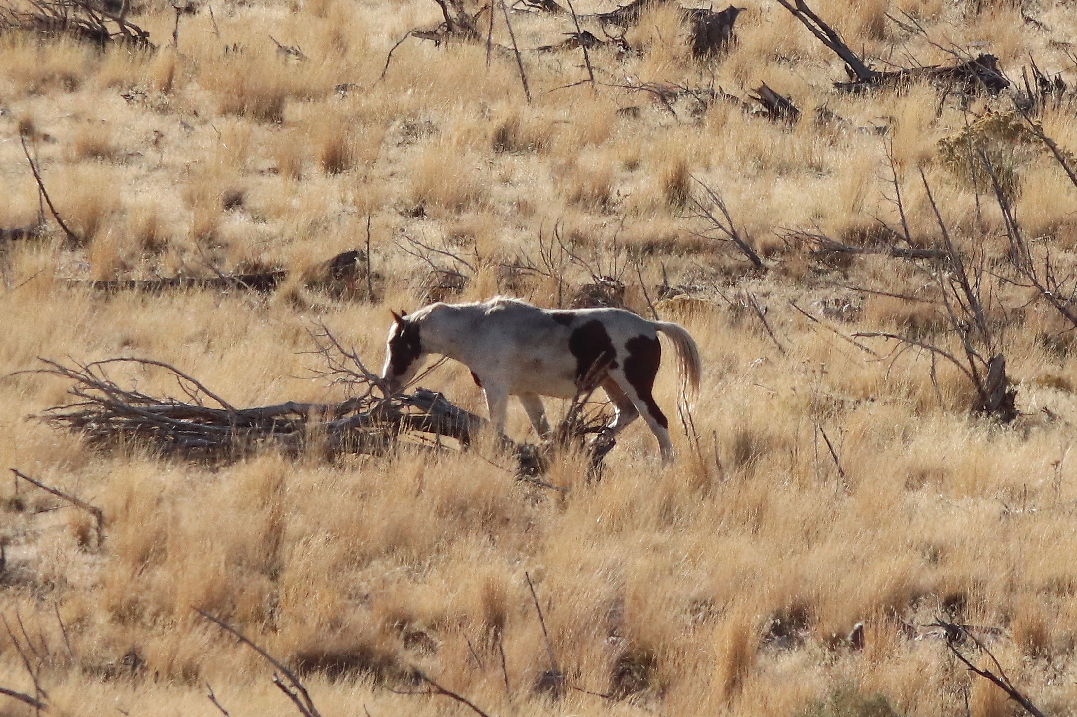
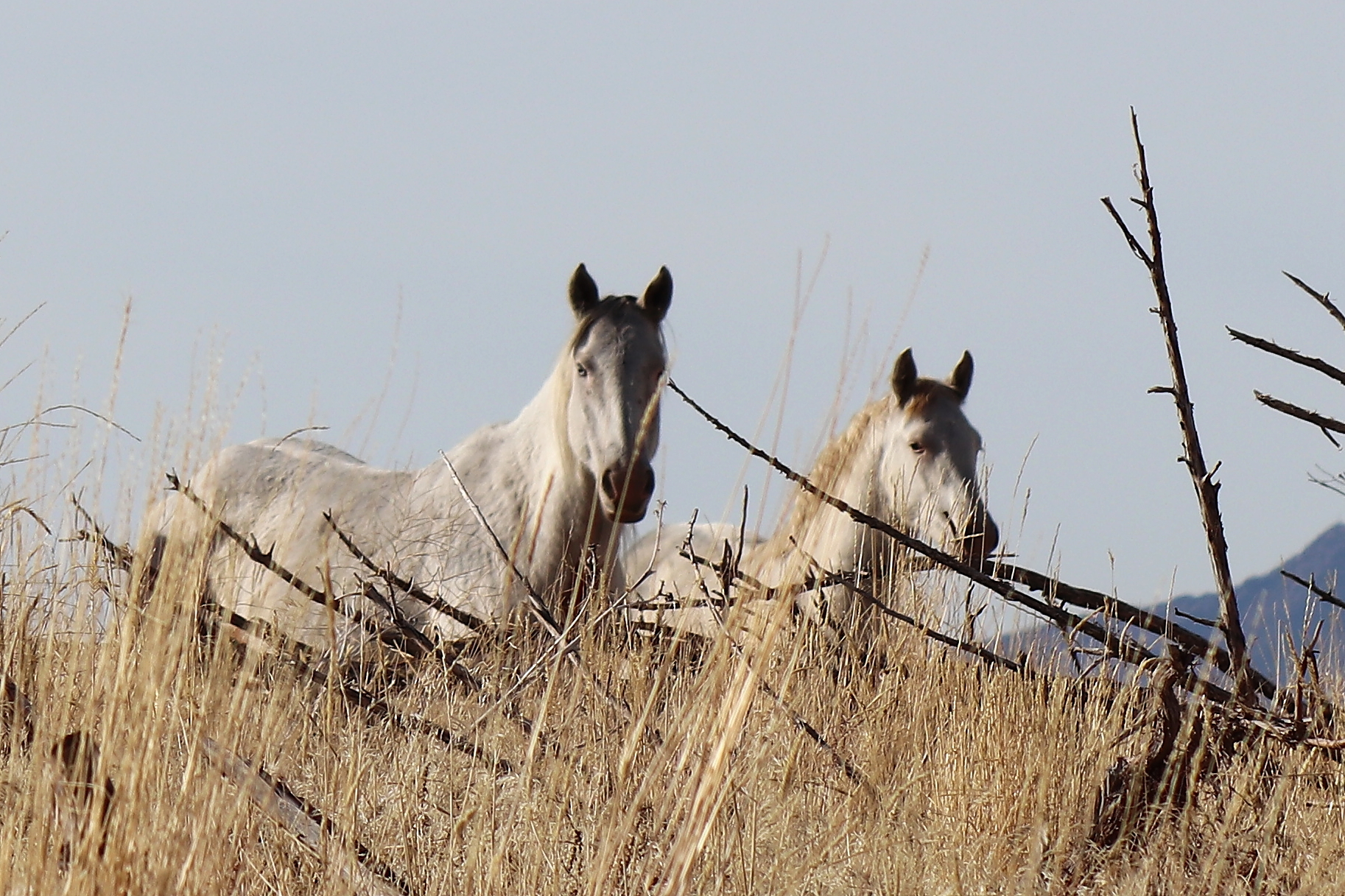
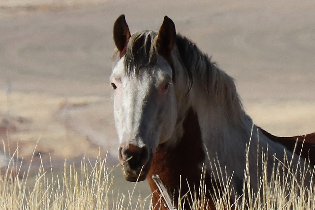
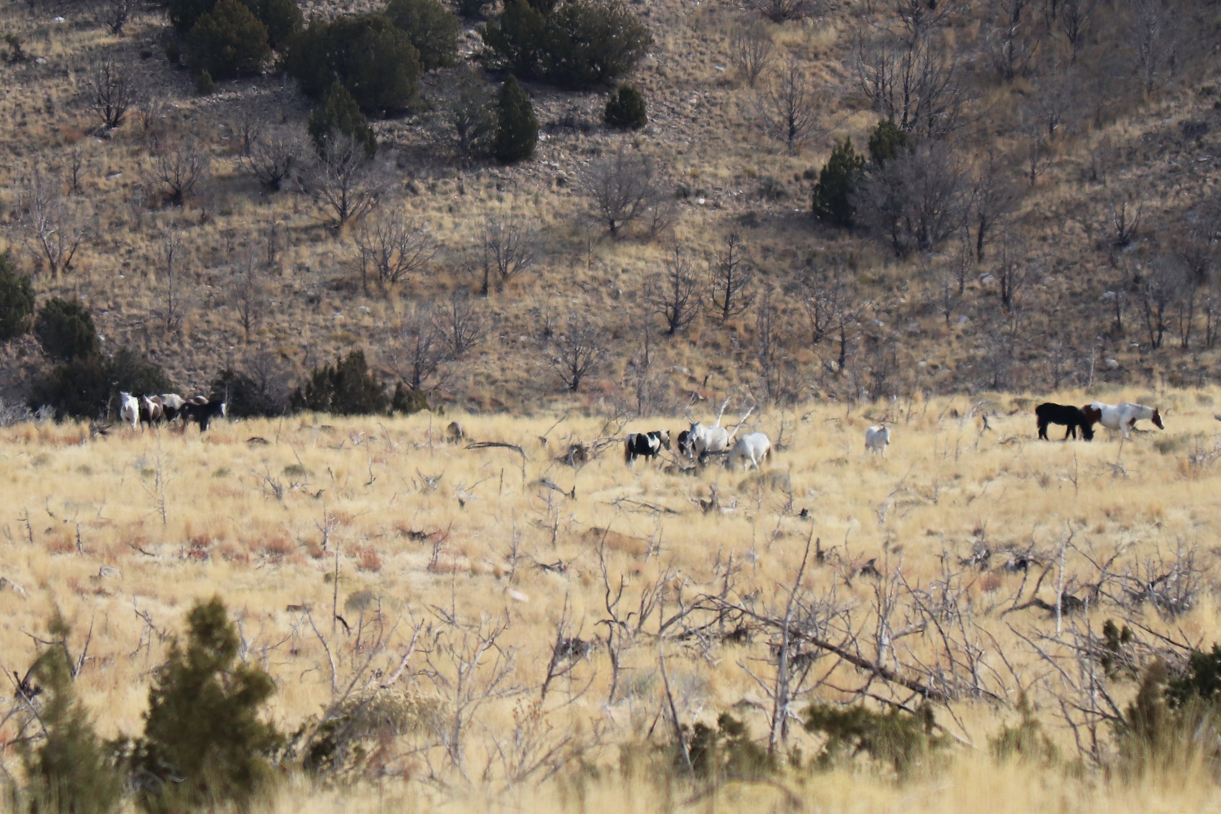
Big Creek is a very small herd area in the middle-elevation foothills of the Stansbury Mountains, stretching along the eastern bank of Skull Valley. Ranging across BLM, National Forest and privately-owned land, it supports a tiny herd population estimated at 10 horses in the BLM’s 2017 Herd Statistics Report. The good news is that a November 2017 trip into this area yielded sightings of double that number.
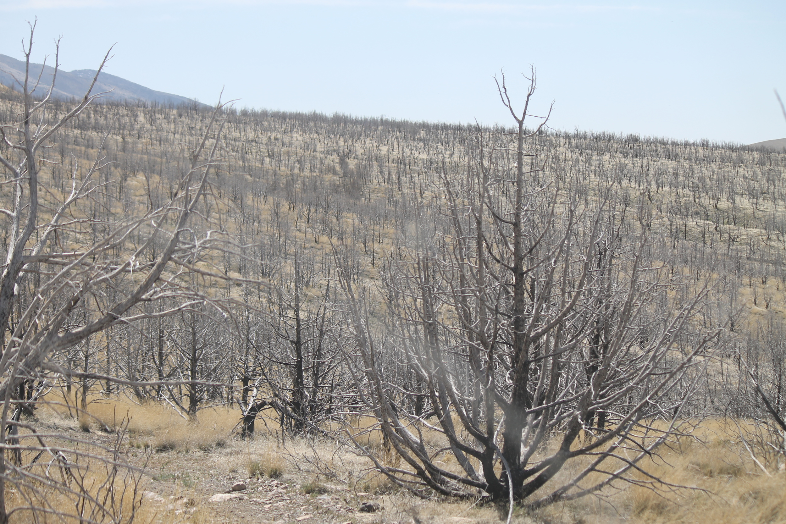
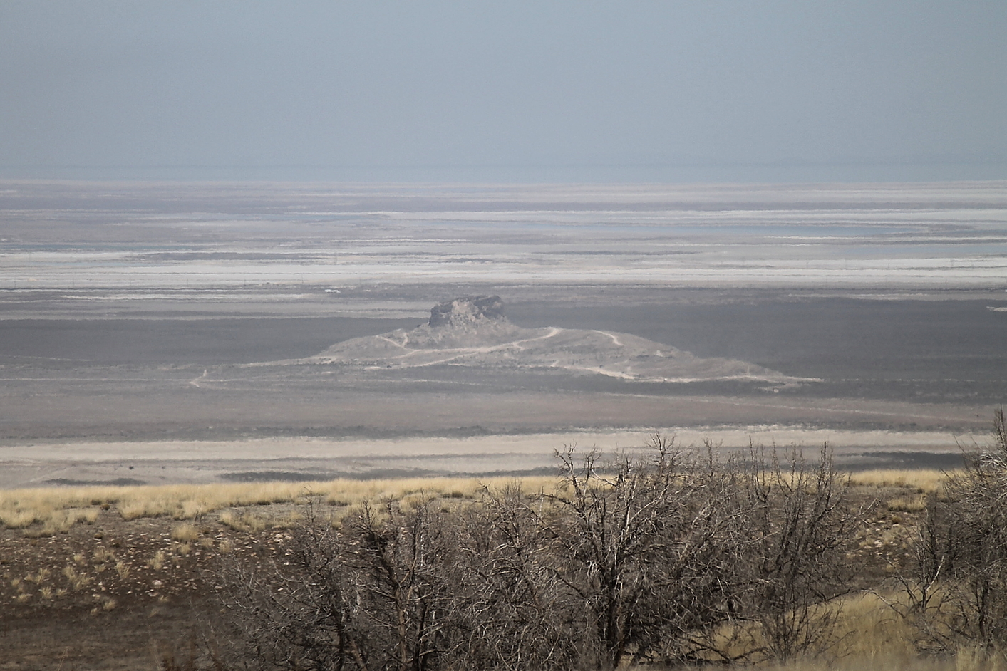
On August 6, 2009, lightning sparked a fire that stripped this area bare, as high winds fanned the flames across 44,000 acres. The Big Pole Fire, as it was dubbed, left only blackened skeletons of tens of thousands of juniper trees across a five-by-fifteen mile swath along the eastern side of UT-196. Access to the area was restricted for several years thereafter to allow rehabilitation. Restrictions were lifted September 29, 2017. Grasses and low-lying shrubbery blanket these hills again, but the devastation wrought by that fire remains evident nearly everywhere you look.


Numerous roads and jeep trails interweave the area, but it is difficult to differentiate public from private land without a map identifying ownership, so please pay close attention to the information provided here to avoid trouble with local land owners.
NOTE: This is strictly high-clearance 4WD country. Also, the area is closed to vehicle traffic from January 1st through April 30th to protect critical winter habitat for local deer.


Getting there
From Salt Lake City, the route begins the same as the directions to the Cedar Mountains: take I-80 west from Salt Lake City approximately 43 miles to Exit 77 (U-196, Iosepa/Dugway). Upon exiting, turn left at the stop sign and continue along UT-196. Along the way, you will pass Lone Rock after 3 miles and approach Horseshoe Spring 6.5 miles later.
Immediately before the turnoff to Horseshoe Spring (west side of the road), you will see the sign indicating the turnoff to the Horseshoe Knolls ATV trails on your left. Exit the highway here and follow the dirt road east to the gated fence. If the gate is closed, remember to close it behind you after you pass through.
The road gets rough pretty quickly as you proceed. Follow as the road turns south about 1.3 miles in from the highway and begins to gain altitude more rapidly. Keep to the right when the road forks 1.5 miles later (First Fork), and again after another 0.8 mile (Second Fork). Continue another 1.2 miles until the road ends at a T intersection with Little Granite Road. Turn right here, then left when the trail forks again almost immediately (Third Fork). Continue south along this trail about 0.2 mile until it merges onto Salt Mountain Road. Follow this graded road 2.5 miles south through the Salt Mountain foothills.
The road curves westward as you exit these hills, adjoining Spring Pond Road for a short distance. Salt Mountain Road curves southward again about 200 yards below the eastern leg of Spring Pond, so take the left fork rather than following Spring Pond further west.
Continue generally south for 3 miles until the road turn sharply to the west. The road will veer southwest about halfway along this stretch when you reach Big Pole Canyon (where you may have to cross shallow water). Shortly after turning westward, you will find yourself driving along a fence line, with private property on your passenger side for about 0.6 mile as you descend toward Threesound Road. Keep to the right as another trail joins from the east and continue west a short distance until the road turns southward, about 0.3 mile to the intersection with Threesound Road (running west).


Astute map readers will notice that Threesound Road appears to provide a direct route east from UT 196. This is true, but most of that three-mile stretch is across private land. Threesound is gated (but not locked) at the highway, and a “no trespassing” sign is posted on the fence beside the gate. I do not know the status of public right-of-way across this property, so I do not recommend this route. Better to take the backcountry roads from Horseshoe Knolls, maximizing your wildlife viewing opportunities and minimizing your trespassing risk.
viewing locations
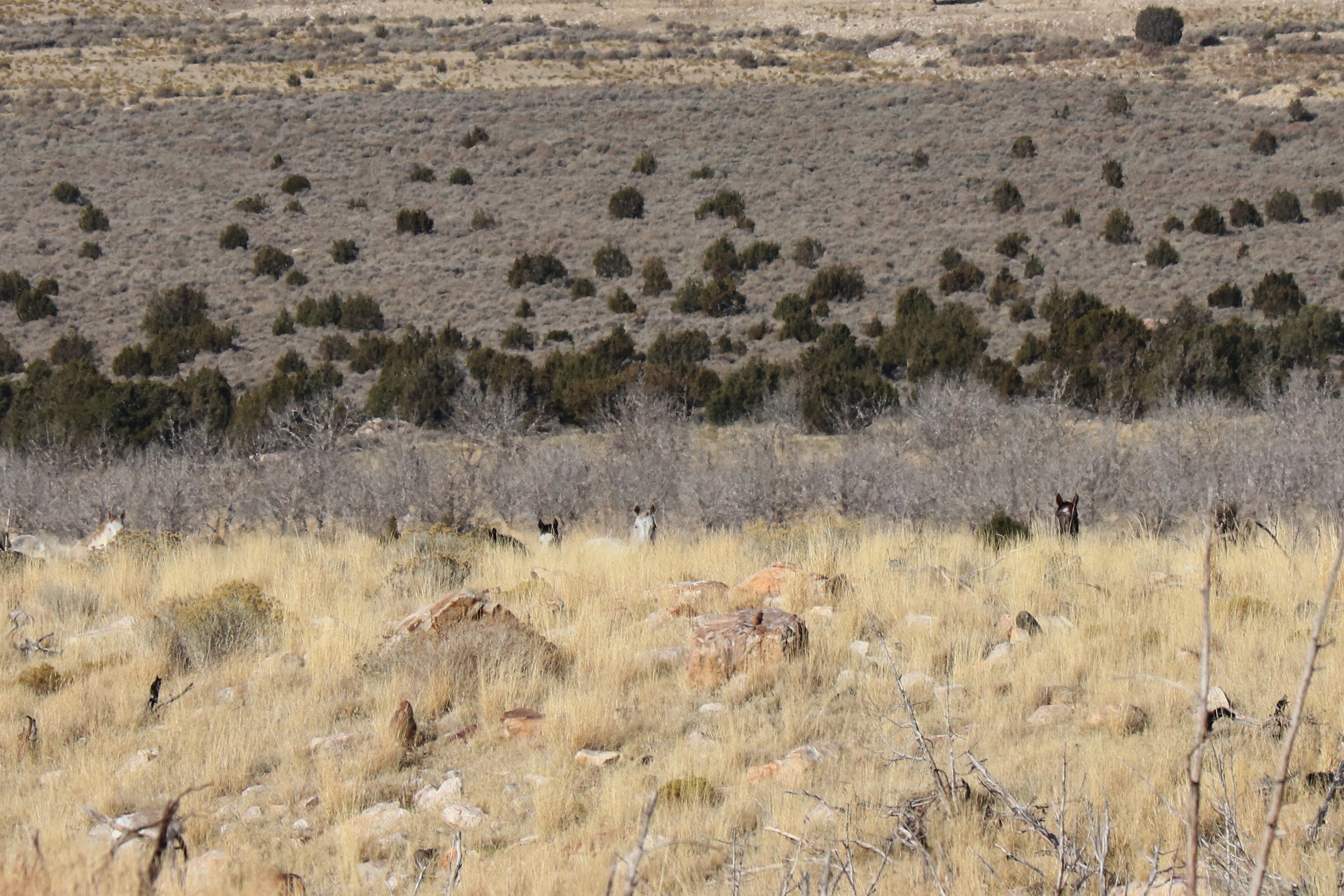
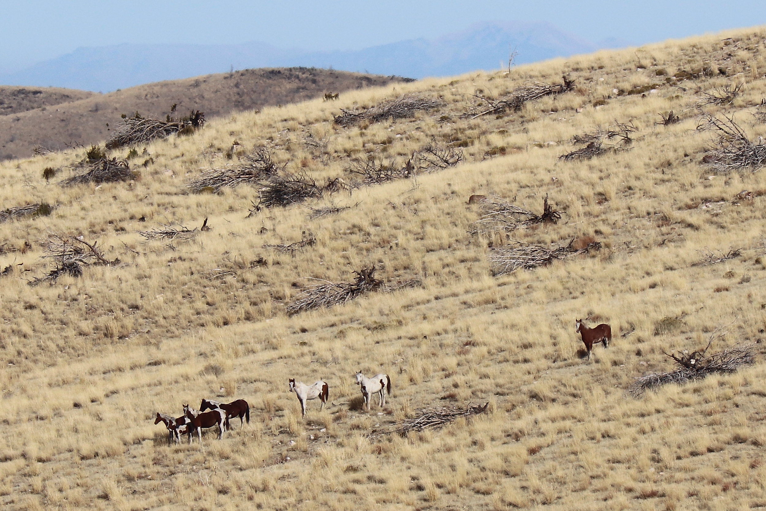
I found the 20 horses mentioned earlier – one band of 8 and another of 12 – grazing the rolling hills between Spring Creek (east of Threesound Rd) and Big Creek (about a mile south) in early November 2017. The best spot that day was near the mouth of Big Creek Canyon, which provided a great view across the intervening alluvial fan to the north and downward to the west. The smaller band was slowly roaming southward from Spring Creek, while the larger band was within 30 yards of Big Creek Road.
To reach this spot, drive south from the T intersection at Threesound Road 0.9 mile to Big Creek Road. Turn left and climb eastward about 0.8 mile.
Other Points of Interest
Lone Rock dominates the landscape immediately south of I-80. The photo above, taken from inside the herd area, shows why some refer to this formation as Submarine Rock.
Horseshoe Spring flows immediately west of UT-196. A small parking lot provides access to a short boardwalk trail.
Horseshoe Spring OHV Trails etch the knolls east of the highway opposite Horseshoe Spring.
The Iosepa Cemetery rests about 4.5 miles south of Horseshoe Spring. Several monuments tell the story of a pioneering Polynesian community that brought this valley to life for nearly three decades, from 1889 through 1917.
Key Coordinates
- Horseshoe Knolls from UT 196: 40° 36.925' N 112° 42.200' W
- First Fork (right): 40° 35.871' N 112° 40.204' W
- Second Fork (right): 40° 35.268' N 112° 40.484' W
- T intersection with Little Granite Road: 40° 34.492' N 112° 41.067' W
- Third Fork (left): 40° 34.483' N 112° 41.116' W
- Salt Mountain Road: 40° 34.324' N 112° 41.043' W
- Spring Pond Rd joins Salt Mountain Rd: 40° 32.473' N 112° 41.011' W
- Salt Mountain Rd leaves Spring Pond Rd (left): 40° 32.464' N 112° 41.049' W
- Big Pole Crossing: 40° 30.919' N 112° 40.653' W
- T intersection with Threesound Rd: 40° 30.294' N 112° 41.923' W
- Big Creek Road: 40° 29.551' N 112° 42.154' W
Nearest Herd Areas
Cedar Mountains: 20 miles
Onaqui Mountains: 45 miles
Oquirrh Mountains: 55 miles