
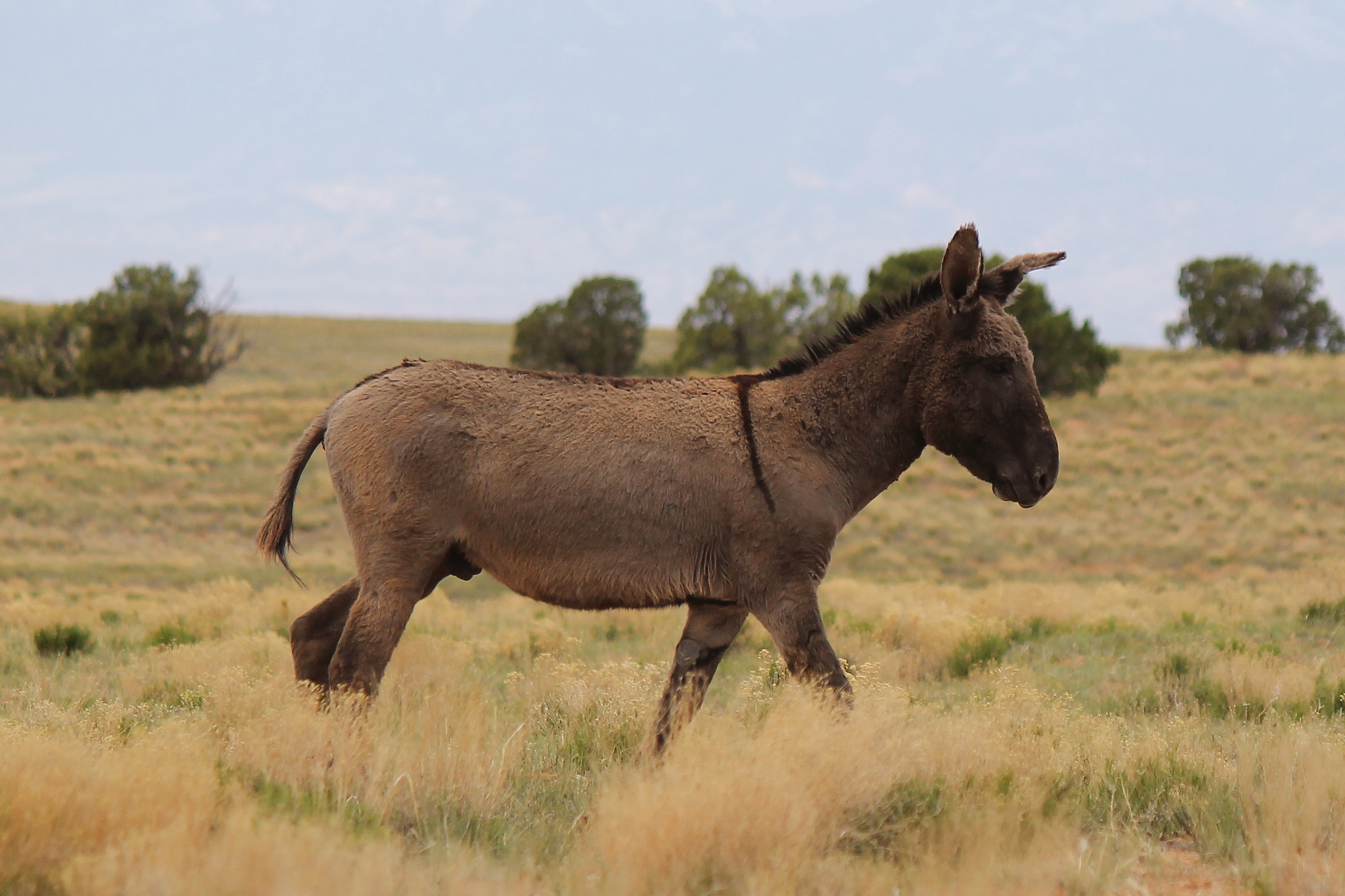
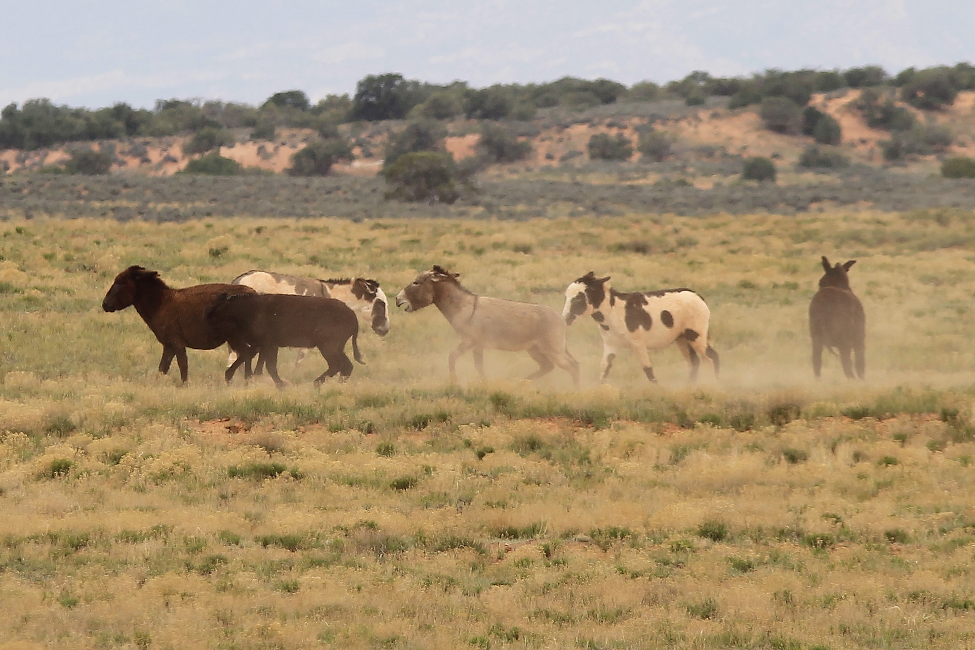
Members of a band grazing beside Roost Road.
Wild burros in Canyonlands? I’ve visited this National Park several times over the years, and never heard nor read a word about them. Big horn sheep, sure … but burros? Well the thing is, like most Canyonlands visitors, I had never been to the western side. I had no idea what I was missing!


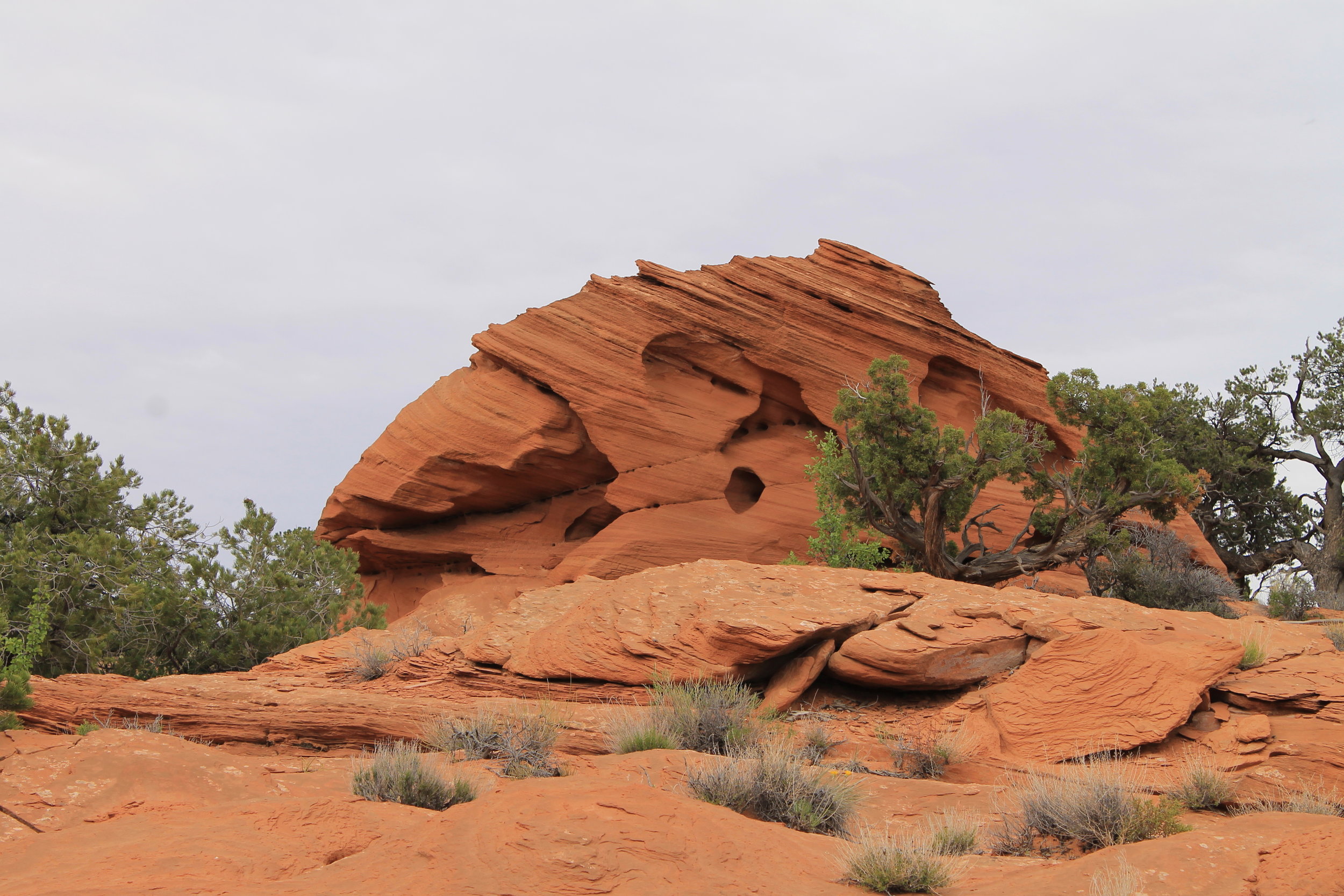
When it comes to adventures in red rock country, the eastern side of Canyonlands National Park has something for everyone: the iconic view of the Colorado River from Dead Horse Point; 4WD trails to satisfy every level of mechanical and technical ability; petroglyphs, pictographs or dinosaur footprints seemingly around every turn; camping, fishing, hiking, mountain biking, white water rafting; isolated natural arches, with the famous dense collection of Arches National Park right next door … and the list goes on. Just merge in with the traffic and follow along.
There is a very good reason most people never visit the west side: it’s a long way from civilization. While Moab places you mere minutes from amazing experiences (traffic permitting), the park entrance at Hans Flat is 60 miles from the nearest town – at least 45 of which are unpaved. But the journey yields incredible rewards for campers, hikers, mountain bikers, off-roaders, photographers … all in an area boasting more burros than humans. I spent two days in this area toward the end of April 2017, and encountered just one other vehicle traveling the roads outside the park, two extremely friendly and helpful park rangers – Ranger Jen and Ranger Jim – and dozens of wild burros.
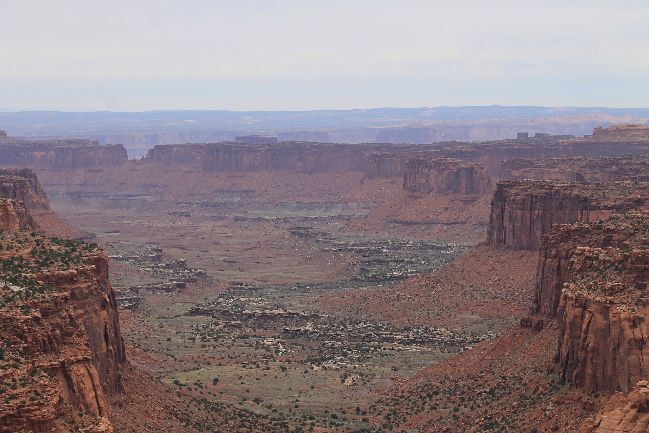
Make no mistake, this is still Canyonlands, and it offers some of the most amazing views anywhere on the planet – every bit as stunning and beautiful as any spot on the eastern side. The images below were taken at my camp site, a few miles outside the park boundary. Cleopatra’s Chair was clearly visible, about eleven miles to the east – and boy, was I in for a treat as sunset approached!


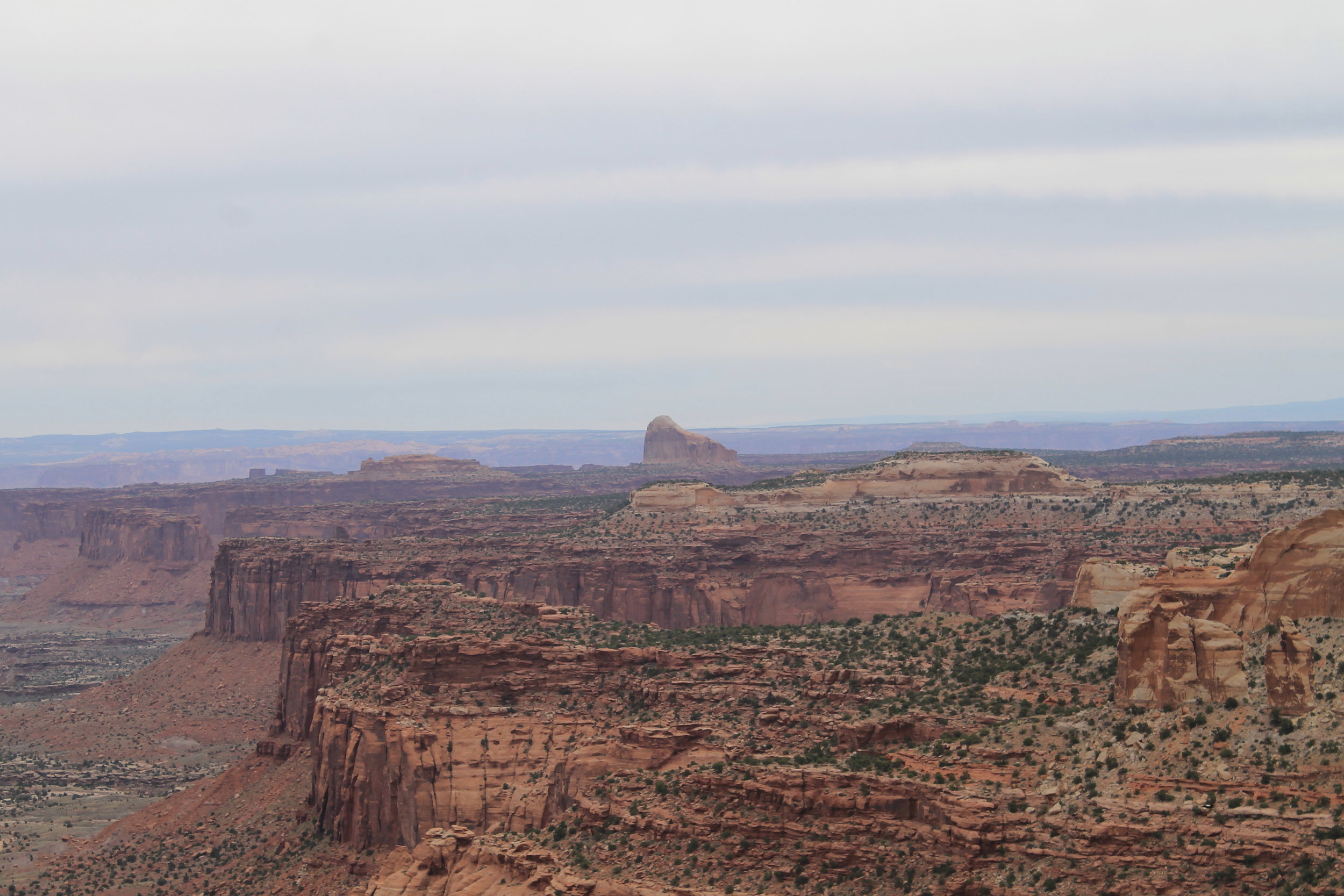
The drive to Sam’s Mesa offers fantastic views from both sides of the road, with Sam’s Mesa Box Canyon to the north and Happy Canyon stretching south.


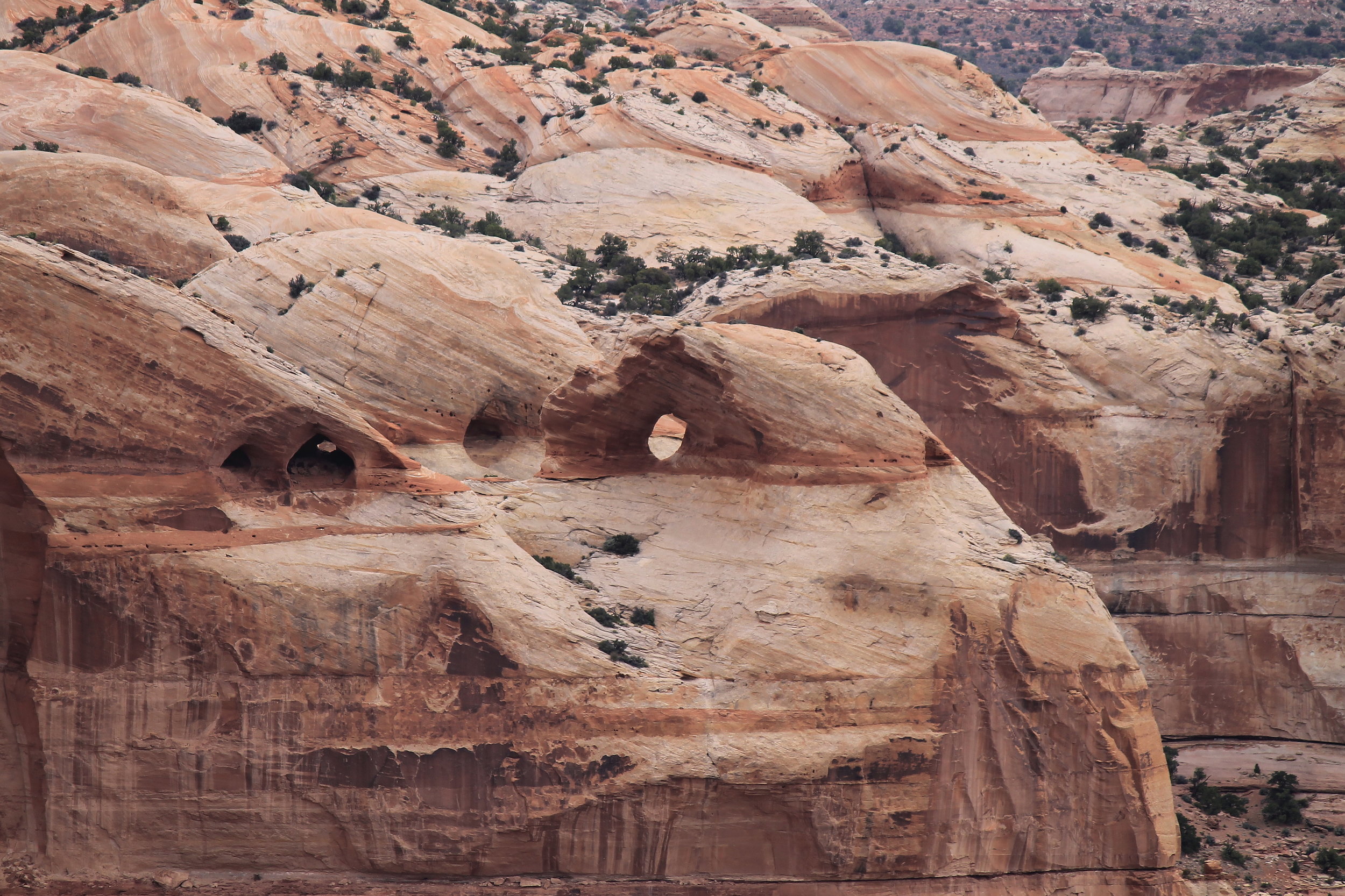
But the view that truly took my breath away came at Ranger Jen’s recommendation. If you’re not looking for it, you might miss the old wooden sign marking the Millard Canyon overlook about a mile beyond the ranger station. An easy 70-yard hike through the junipers, and you’re suddenly confronted by a sheer 1,200-foot drop. Gazing north across the chasm, small natural arches top the rim about a mile from where you stand. Six miles northeast, Cleopatra’s Chair rises above the jagged golden arms of the canyon's several eastward branches. It is incredible! Thanks again, Ranger Jen!

One thing to be aware of if you are planning to camp in this area: the ≈wind≈ across these plateaus above the canyons can be strong and unrelenting, with its own spitefully aggressive ideas concerning your tent and your campfire. Of course, there are good days, and not-so-good days (especially given even the least hint of storminess). It's probably a bigger problem during spring and autumn, when the weather tends to be more unsettled - and of course, summer brings intense heat! Be prepared for either situation.


Getting There
For the most direct route from Green River, begin at Main Street and Broadway (look for the Melon Vine Food Store sign on the southwest corner). Follow Broadway south just under 0.2 mile. Watch for a small white building on your right with a large sign reading “Epicenter” above the door. Turn left as you pass this building onto Green River Ave (the right-hand option of the two roads branching to your left). Continue southeast 0.3 mile to Airport Road (watch for the sign reading “Airport 5 Miles”). Turn right, crossing the railroad tracks and continuing westward 2.4 miles. Turn left onto the dirt road leading into the San Raphael Desert, and follow this main road (Lower San Raphael Rd) generally south 8 miles to Horse Bench Reservoir, another 31.5 miles to Horseshoe Canyon, and 5.5 miles further as the road veers westward to the Hans Flat turnoff, for a total of 45 miles since leaving the pavement.
At this point, you are just entering the Robbers Roost herd area. Continuing west will take you to the locations described on that web page, and ultimately to UT-24, just south of Goblin Valley State Park.
To continue into wild burro country, turn left toward Hans Flat, heading south on Roost Road. Keep left, continuing toward Hans Flat, when the road forks 7.1 miles later. Another 6 miles takes you to the area where most of the photos shown here were taken. The turnoff to the camp site viewing Cleopatra’s Chair is 6.2 miles from the Hans Flat turnoff, but there are several inviting camping spots along this stretch of road. Plan on about 2:15 travel time for this route.
An alternative route, detailed in the Robbers’ Roost HMA page (and hinted at above), follows US-70 west to UT-24 (toward Hanksville and Goblin Valley) before turning into the desert from the west. This route adds 16 miles one way, but two-thirds of this route is paved, cutting about 20 minutes travel time.
Whichever route you choose, 2WD will usually get you all the way to the Hans Flat Ranger Station (and a couple of miles beyond), although deep sand can be a problem if coming in from UT-24.
Viewing Locations
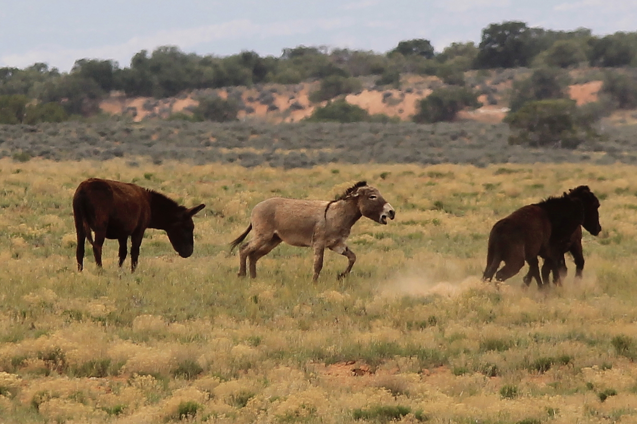
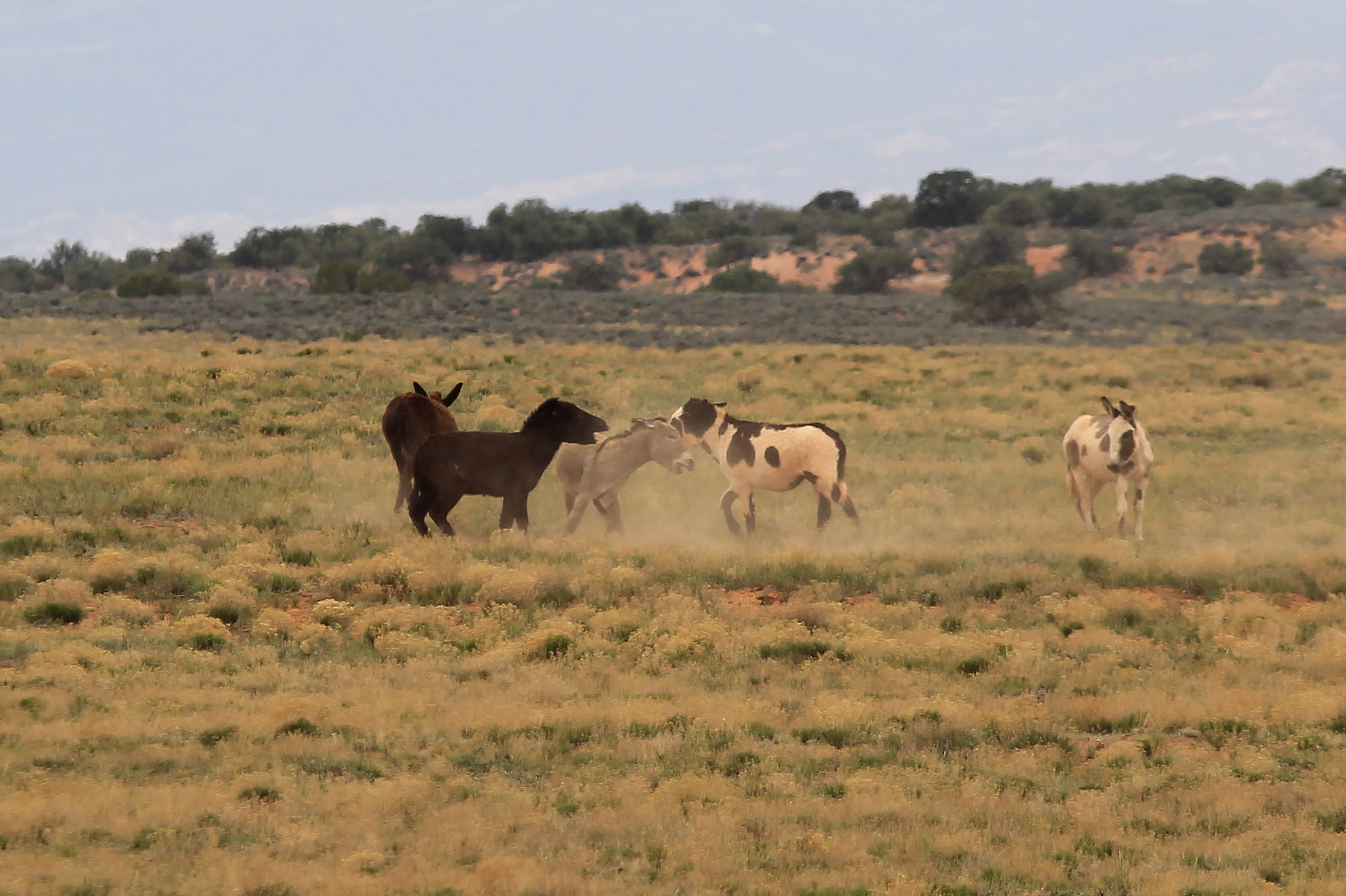
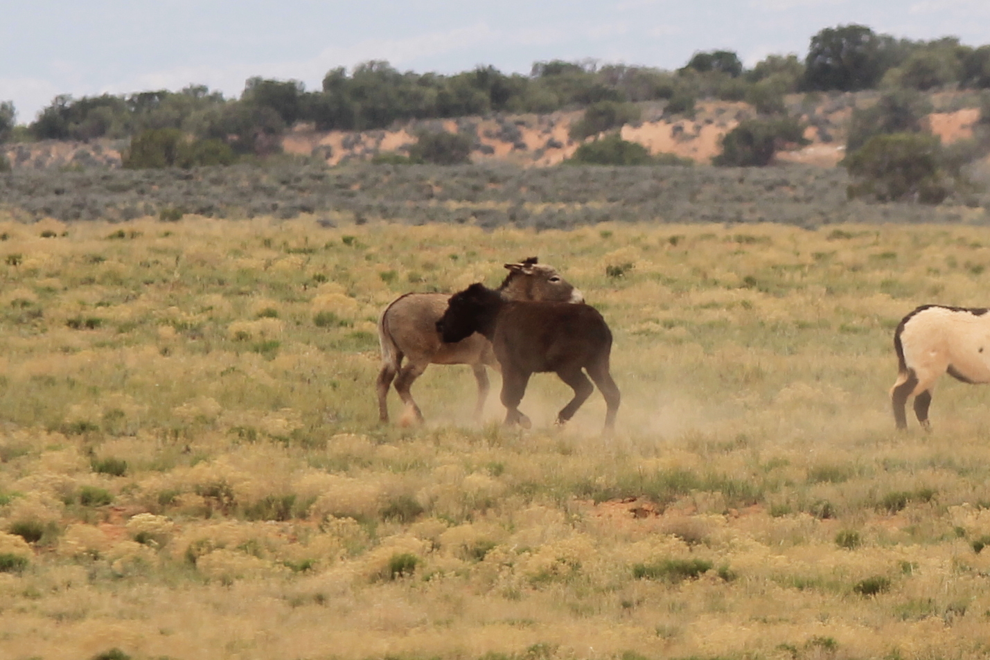
Most of the burros pictured here were found grazing the broad plains west of Roost Road. The 2 to 3-mile stretch southward to the Sam’s Mesa turnoff seems to be prime burro viewing territory.


This couple with their little brown foal were spotted on the road to Sam’s Mesa, which is well worth the drive for the scenery alone. High clearance will not be required for this 9.8-mile drive, but you’ll want 4WD through some of the sandy stretches, which can be surprisingly soft. There are several turnouts for camping toward the top of this road – some immediately overlooking Happy Canyon – but as with the Roost Road location, beware of the ≈wind≈.


Other Points of Interest
1) If you’re looking for a seven-mile hike with a 750-foot climb at the end, you could A) sign up for Marine Corps boot camp and pack your gear up Mount Mother****** after a long hump to the night-fire range or B) visit Horseshoe Canyon and pack your camera and binoculars down to the pictograph galleries and back. Either option offers its own rewards, but most will probably find plan B more enjoyable. The National Park Ranger-led Program offers guided hikes during the more temperate spring and autumn months. Acutally, option A was guided as well (to understate the experience just a bit); but more than just a few years have passed, so check with your local recruiter to see if they still offer that "hike".
2) Since you’ve come all this way, take a few minutes to visit the Millard Canyon overlook. You will not be disappointed!
3) With high-clearance 4WD and an adventurous spirit, you can make the 9-mile drive out to Cleopatra’s Chair and Panorama Point. Be prepared for several stretches of rocky steps and ledges along this trail (my stock-suspension Wrangler cleared everything just fine). The friendly rangers at Hans Flat can provide maps and advice for several other off-road adventures in this area.
4) Oh, there's more. This is Canyonlands!!!
Key GPS Coordinates
a. Airport Rd, Green River: 38° 59.388' N110° 9.664' W
b. San Rafael Desert from Airport Rd: 38° 57.723' N110° 11.261' W
c. Horseshoe Canyon turnoff: 38° 29.732' N110° 12.479' W
d. Roost Rd from Lower San Raphael Rd: 38° 28.351' N110° 16.821' W
e. Hans Flat/Ekker Ranch Fork: 38° 22.667' N110° 18.308' W
f. Sam's Mesa Rd from Roost Rd: 38° 15.973' N110° 16.109' W
g. Sam's Mesa: 38° 11.788' N110° 20.636' W
h. Hans Flat Ranger Station: 38° 15.317' N110° 10.788' W
i. Millard Canyon Overlook: 38° 14.876' N110° 10.146' W
Nearest Herd Areas
Robbers Roost: 15 miles northwest
Sinbad: 75 miles northwest (more burros)
learn more about efforts to protect America's Wild Horses and Burros:


Wild Horse Tourist is not affiliated with any of these organizations, but we encourage you to support their vital mission.