
Winter Ridge Herd Area
A summertime paradise for wild horses -- and bison!

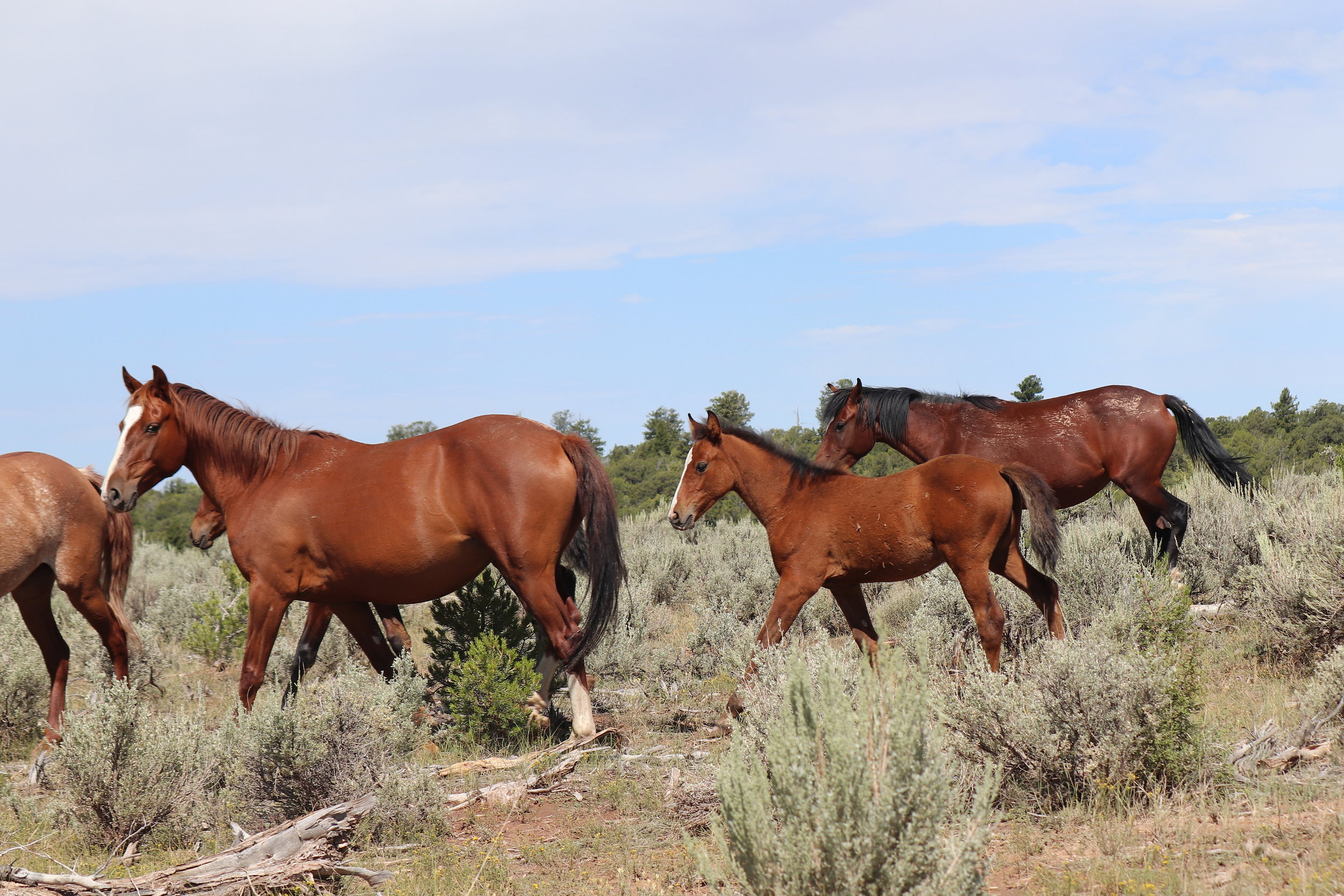
Pair with foal near Bull Canyon.
wild horse heaven's upper deck
The Winter Ridge herd area encompasses nearly 75 square miles of the Book Cliffs region of southern Uintah County, including a sliver of northern Grand County. A 1999-2001 outbreak of equine infectious anemia (EIA) in the Uintah Basin, combined with concerns for herd sustainability through harsh winters in these high elevations (approaching 8200 feet along Book Cliffs Ridge) caused the Bureau of Land Management to adopt a zero-population policy for this herd area in 2008. Toward that end, 109 mustangs were removed in September 2011, none of which tested positively for EIA.


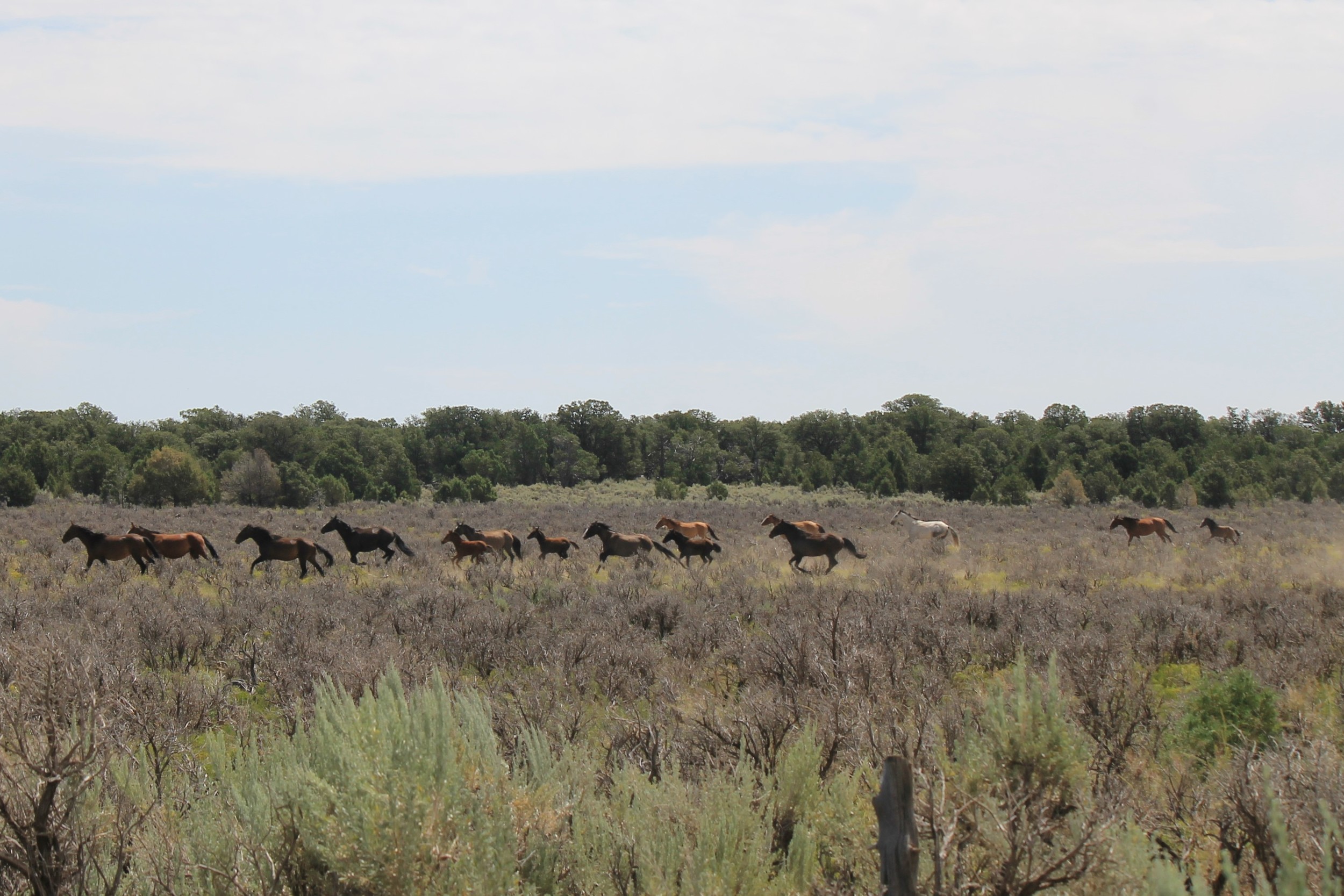
Although the BLM’s zero-population policy appears to remain in force, mustangs continue to migrate into this area across contiguous borders with the Hill Creek Herd Area and the Ouray Ute Reservation. During a late-July 2016 visit, I encountered several bands throughout the area, with particular concentration in the northwestern sector surrounding Bull Canyon Road.


Also spotted in this sector – to my great surprise – American bison! Eradicated from this region a century or more ago, the Ute tribe reintroduced free-roaming bison in 1986. The growing stock has since been augmented on several occasions, including introduction of members from the genetically-pure Henry Mountains herd. Many of these Book Cliffs bison are collared and tagged for individual identification, herd tracking and other sciency stuff.


This remote and isolated area offers excellent wildlife viewing opportunities amid beautiful surroundings marred only by the occasional natural gas well. Cool and shady undeveloped camp sites can be found along Winter Ridge and Bull Canyon roads, with more secluded opportunities (if remote and isolated isn't quite enough for you) along many of the numerous side roads.


Getting There
This area may be viewed as a high-elevation extension of the Agency Draw sector of the Hill Creek Herd Area. Our Hill Creek page provides directions to Bull Canyon through Willow Creek Canyon (high clearance 4WD recommended). Continue that route to reach the plateau, about 10.9 miles to the T-intersection with Winter Ridge Road. Be aware that the road through Bull Canyon is prone to sever runoff damage and may not be passable for extended periods following significant precipitation.


A longer but quicker and more reliable route follows Seep Ridge Road all the way to the Grand County Border. Although 80% of this route is paved and the final 19 miles of dirt roads are generally well maintained, 4WD is still recommended, as recent rain and runoff combined with frequent heavy truck traffic (servicing natural gas wells) can quickly turn these roads into a rutted mess. Also, if you are not prepared for thick, slippery mud and deep standing water, you should avoid this area entirely during the spring thaw and for a couple of days following heavy rain.
As recommended for the Hill Creek tour, start with a full tank of gas in Roosevelt (or Vernal). Take US-40 about 14.5 miles east from Roosevelt (about the same distance west from Vernal) to Utah Highway 88. Watch for the sign pointing toward Pelican Lake and the Ouray National Wildlife Refuge between mile markers 130 and 131. Travel southward past Pelican Lake, about 17 miles to Ouray and the Green River crossing.
You’ll be passing through tribal land for the first 9 miles beyond Ouray along Seep Ridge Road, and mustang sightings are likely. Another 20 miles brings you to the tiny rest stop at the Buck Canyon turnoff (mile marker 25). Continue southward on Seep Ridge Road 26.5 miles (pavement ends near the Grand County border), turning right onto Book Cliffs Ridge Road (BLM 194). Follow this road 9.1 miles to Winter Ridge Road (BLM 201 -- and how ‘bout that view to your left about halfway in, huh?). A final 10-mile stretch takes you to the intersection with Bull Canyon Road (which tees to the right).


A direct round trip from Roosevelt (or Vernal) is about 175 miles through Willow Creek Canyon, 215 miles if you take the alternative Book Cliffs Ridge route there and back. Combine the two routes into a continuous loop and split the difference at about 195 miles. No fuel, food or water available in these deep wilds, so leave fully prepared.
One final cautionary note: you may be tempted to try the road continuing south from the Book Cliffs Road/Winter Ridge Road intersection, which appears to be a well-groomed route down toward Interstate 70. It is ... until you get about halfway down. This road runs through Hay Canyon, which is a primary runoff collector particularly prone to flash flooding and severe washout damage, ripping gouges through the road a furlong wide and leaving quicksand in its wake. It's a rough route through the middle elevations even in the fairest weather, and you probably won't know exactly what you'll find until you're already in it. I'm asking you to take my word for it on this one: Do as I say, don't do as I done.


viewing locations
On the warm summer day I last visited this area, mustangs were plentiful in the area north and west of the Winter Ridge/Bull Canyon intersection. I also spotted a few bands and lone bachelors along Winter Ridge Road almost as far south as Book Cliffs Ridge. Nearly every camping spot I investigated along Winter Ridge Road included hoof tracks passing near or through the site.
The bison, like the horses, are free to roam wherever their foraging takes them, but I happened upon the grazers shown above while exploring a jeep trail in the northwestern corner of this herd area, about two miles west and then a mile north of the Winter Ridge/Bull Canyon intersection.


Other Points of Interest
The Hill Creek Herd Area page includes a few points of interest along the journey south from US-40. As far as other attractions specific to this area go, they would only be distractions. Whether you take the slower winding shortcut through the gorgeous Willow Creek Canyon, or the longer route along the breathtaking vistas of Book Cliffs Ridge, this area is an attraction all its own.
Key Coordinates
Exit US-40 to UT-88: 40° 19.156' N109° 41.652' W
Green River Bridge at Ouray, UT: 40° 5.127' N109° 40.566' W
Pelican Lake: 40° 11.001' N109° 41.510' W
Ouray National Wildlife Refuge: 40° 8.052' N109° 38.610' W
White River Bridge: 40° 3.860' N109° 40.447' W
- Rest Stop (near Buck Canyon Rd): 39° 44.350' N109° 30.128' W
Bull Canyon entrance from Willow Creek Canyon: 39° 36.470' N109° 33.845' W
Book Cliffs Ridge Rd from Seep Ridge Rd: 39° 27.154' N109° 16.474' W
Winter Ridge Rd from Book Cliffs Ridge Rd: 39° 25.003' N109° 23.871' W
Bull Canyon Rd and Winter Ridge Rd: 39° 29.532' N109° 32.266' W
Nearest Herd Areas
Hill Creek: immediately north
Bonanza: 60 miles northeast